Have you ever tried to place the whereabouts of a family member who served during The Great War?
We have the medal cards, sometimes the service records and pension records, not forgetting the CWGC who can give a clue to an approximate area of those who gave the ultimate sacrifice, but how a library in Scotland have scanned over 130 Trench Maps from that period in time, covering France and Belgium.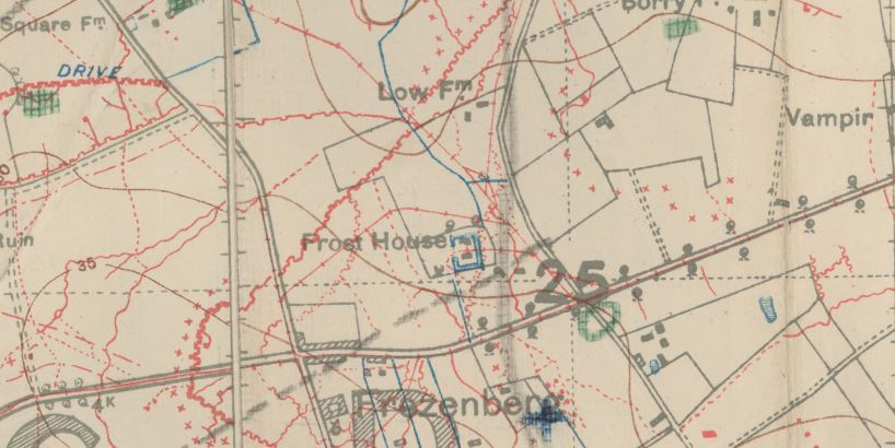
The changing Front Line, with communication trenches as well as enemy positions. Also highlighted are observation posts, guns emplacements, machine gun positions, mines and wire entanglements. Some maps include the names of soldiers that gave the trenches their unique names plus landmarks.
It has been estimated that there were more than 34 million British maps of the Western Front printed during the war years.
These maps are a wonderful resource, adding that little bit of extra information to your soldiers war record.
The National Library of Scotland, who has digitised the maps also includes on their map image link:- maps of Scotland, County maps, Town plans and views, series maps plus more.
Sources
National Library of Scotland